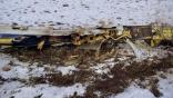
Searchers Find Wreckage Of DHC-3 Seaplane

Sonar
A computer-processed image of the DHC-3 wreckage.
Credit: NTSB

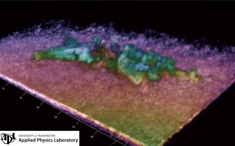
The NTSB confirmed Sept. 12 that it has located the wreckage of the DHC-3 Turbine Otter seaplane that crashed in the Puget Sound off Whidbey Island, Washington, eight days earlier.

Supported by the University of Washington Applied Physics Laboratory (APL) and the National Oceanic and Atmospheric Administration (NOAA), accident investigators located the wreckage at a depth of 190 ft. using side-scan and multibeam sonar and 3D instruments. An APL vessel scanned the area identified from NOAA multibeam data.

The NTSB released computer-processed sonar imagery of the wreckage taken on Sept. 10. Searchers had earlier identified targets by using sonar to map and survey the seafloor where they expected to find debris. But the team awaited visual confirmation that the targets are from the aircraft.

“Using all available data, investigators concluded the targets they identified were from the aircraft,” the NTSB said. “Due to the depth of the water (approximately 190 ft.) and the current (3-5 knots), the most suitable tool for recovery is a work-class remotely operated vehicle (ROV). NTSB continues to be in communication with federal agencies and local companies to obtain a work-class ROV.”

The single-engine DHC-3T turboprop crashed at about 3:09 p.m. Pacific Time on Sept. 4, following what witnesses described as a steep dive into Mutiny Bay. Operated by Friday Harbor Seaplanes, the Turbine Otter had taken off from San Juan Island bound for Renton, Washington, with one pilot and nine passengers aboard, before crashing 18 min. into the flight. Searchers recovered the body of a woman; other occupants have not been recovered and are presumed to have died.

The U.S. Coast Guard led the initial search for survivors before suspending the effort on Sept. 5. The NTSB heads the search for the aircraft wreckage. Investigators narrowed the search area using the aircraft’s last known location, time of entry into the water, and tides and currents, collecting data for a 1.75-by-0.75-mi. area.

Bill Carey

Based in Washington, D.C., Bill covers business aviation and advanced air mobility for Aviation Week Network. A former newspaper reporter, he has also covered the airline industry, military aviation, commercial space and unmanned aircraft systems. He is the author of 'Enter The Drones, The FAA and UAVs in America,' published in 2016.

Comments

1 Comment
Speculation is pointless, but the report of a steep dive is troubling.