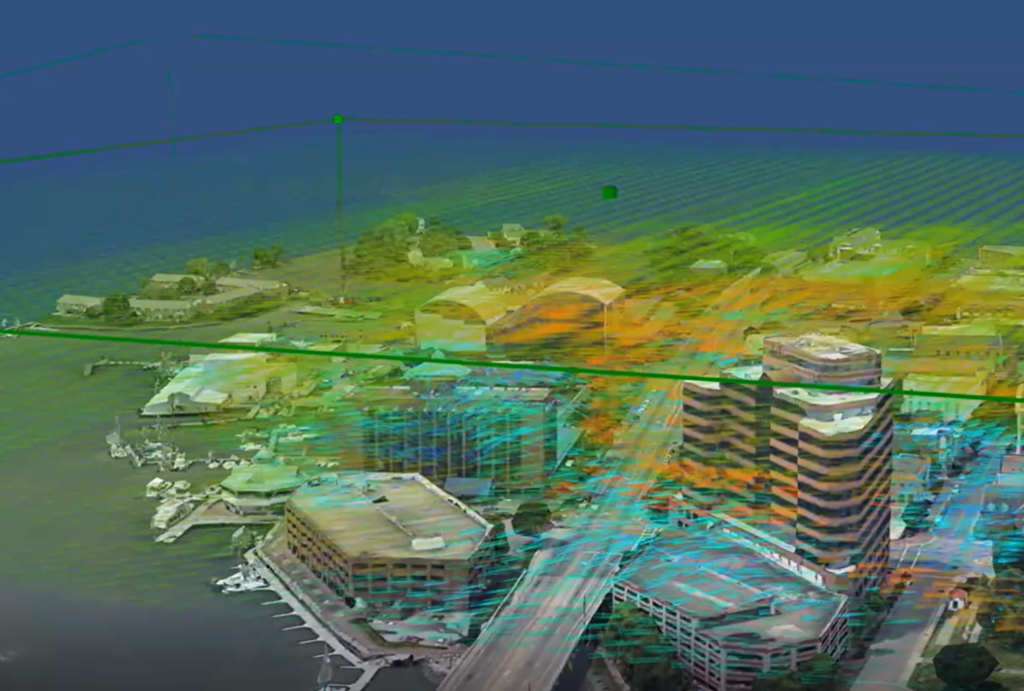
NASA Selects TruWeather To Test Urban Forecast Network

TruWeather simulation of Computational Fluid Dynamics modeling
Credit: TruWeather

NASA has awarded TruWeather Solutions a $750,000 Phase II Small Business Innovation Research contract to test a network of ground-based weather sensors in Hampton, Virginia.

The sensor network is intended to provide weather measurement and prediction data for safe and efficient flights of beyond-visual-line-of-sight uncrewed aerial systems (UAS) and electric vertical-takeoff and-landing (eVTOL) aircraft flying at low altitudes within cities and suburban areas, TruWeather said Sept. 8.

In particular, to facilitate the nascent advanced-air-mobility (AAM) industry, microweather services are needed to improve UAS and eVTOL power management, payload weight estimates, travel times, flight separation and vertiport throughput, the company says.

As part of the test, two Doppler lidars from MetroWeather of Japan will provide what TruWeather calls “MRI-like” wind and potential cloud-height data covering more than 30-40 mi.2, up to 6,000 ft. above the ground. TruWeather will fuse data from the lidars, 30 microweather stations in downtown Hampton, satellite data and possibly a radar to predict where and when it believes it is safe for UAS and eVTOLs to operate.

The company believes the sensor data might have value outside of the AAM industry as well, says TruWeather CEO Don Berchoff.

“We are taking a broader view of this work and also examining how cities can use urban micro-weather data collection as part of SMART City initiatives to serve air quality and green-energy building management, emergency services and other functions within a city that are impacted by micro-weather on a street-by-street level,” he says.

Garrett Reim

Based in the Seattle area, Garrett covers the space sector and advanced technologies that are shaping the future of aerospace and defense, including space startups, advanced air mobility and artificial intelligence.